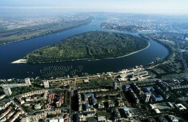
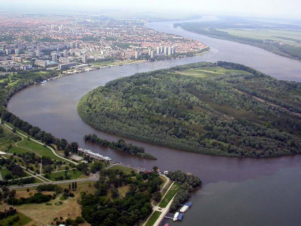
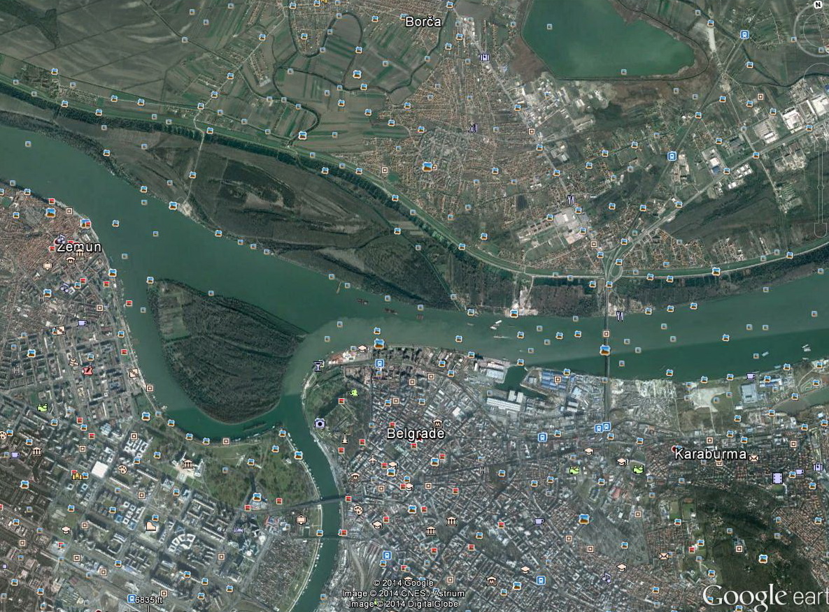
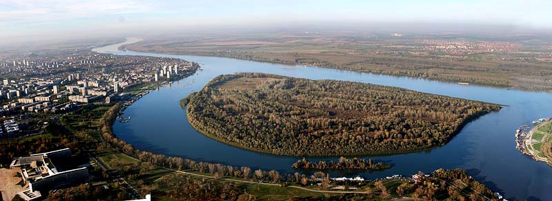
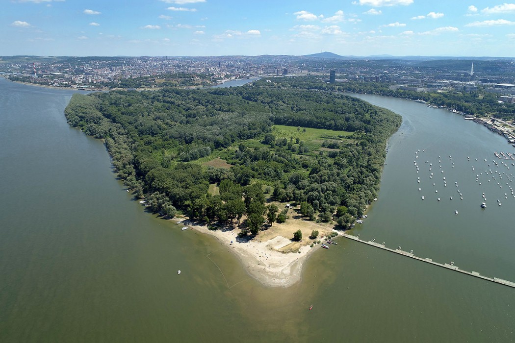
The Great War Island
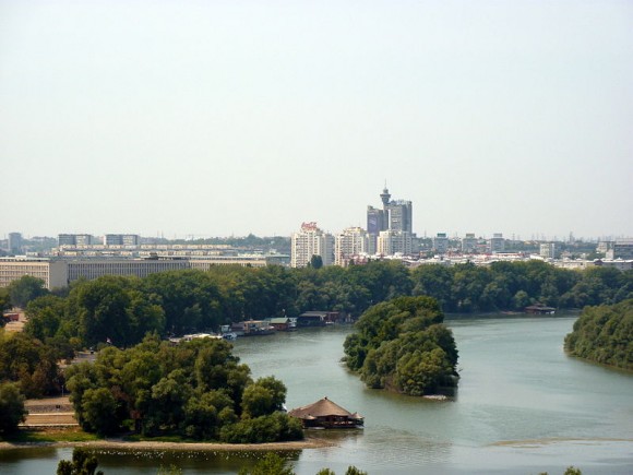
Great War Island is a river island in Belgrade. Covers an area of 2.11 km2 (0.81 sq mi). It is low, for the most part marshy and often flooded by the Danube.It is located at the confluence of Sava and Danube rivers. Though uninhabited, the island is part of the Belgrade City proper, and belongs to the city municipality of Zemun.
Great War Island is not an old geographical feature. Based on the historical data and descriptions of the river battles on the Danube, it is believed that it has been formed in the second half of the 15th century, first as a small sandbank which was then divided and morphed by the Danube’s stream. It appeared on the maps for the first time in the 1514 map by the Hungarian cartographer Lázár Deák. Historian Kome chronicled the fall of Zemun to the Turks in 1521 and mentioned the island as the location where all of the imprisoned defenders of the city were interred, including their wives and children. The island gained its militant name due to its history as an important strategic point either for the conquest or the defence of Belgrade. Also in 1521, when Belgrade was under siege by Turkish forces, the majority of their attacks on Belgrade fortress were launched from the island. The name officially appeared after 1717, when Prince Eugene of Savoy used the island as an attack point in his re-conquest of Belgrade from the Turks. In 1741 a Constantinople convention was signed, which resulted in fixing the border between Austria and Turkey, concerning the islands in the Sava and Danube. By the convention, Turkey obtained the section of the island overlooking the Belgrade, while Austria got the other part, in the direction of Zemun and Banat. In liberating Belgrade in 1806 the rebel army headed by Karađorđe also used the island for military purposes, as the Serbian artillery with 500 soldiers was bombing the Kalemegdan fortress from there. During the offensive in 1915 by Austria-Hungary against Belgrade, Austria-Hungary forces used the island to launch their attacks. After the World War I, island became part of the new Yugoslav state. After 1918, a small colony of 20 destitute inhabitants of Zemun built stilt houses on the island which was then colloquially called “Sirotinjska Ada” (Poor man’s Island). Also, a sandbank facing Zemun was adapted into the beach, being predecessor of the modern Lido beach.
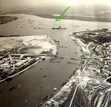
When construction of Novi Beograd began in 1948, the city government made a decision to completely destroy the island by using its sand and earth to cover the marshes of Syrmia, where new city was to be built. However, the deposits of alluvial materials continually brought onto the island from the Danube completely prevented this from happening. Instead, the smaller Little War Island served this purpose and was nearly destroyed in the process.
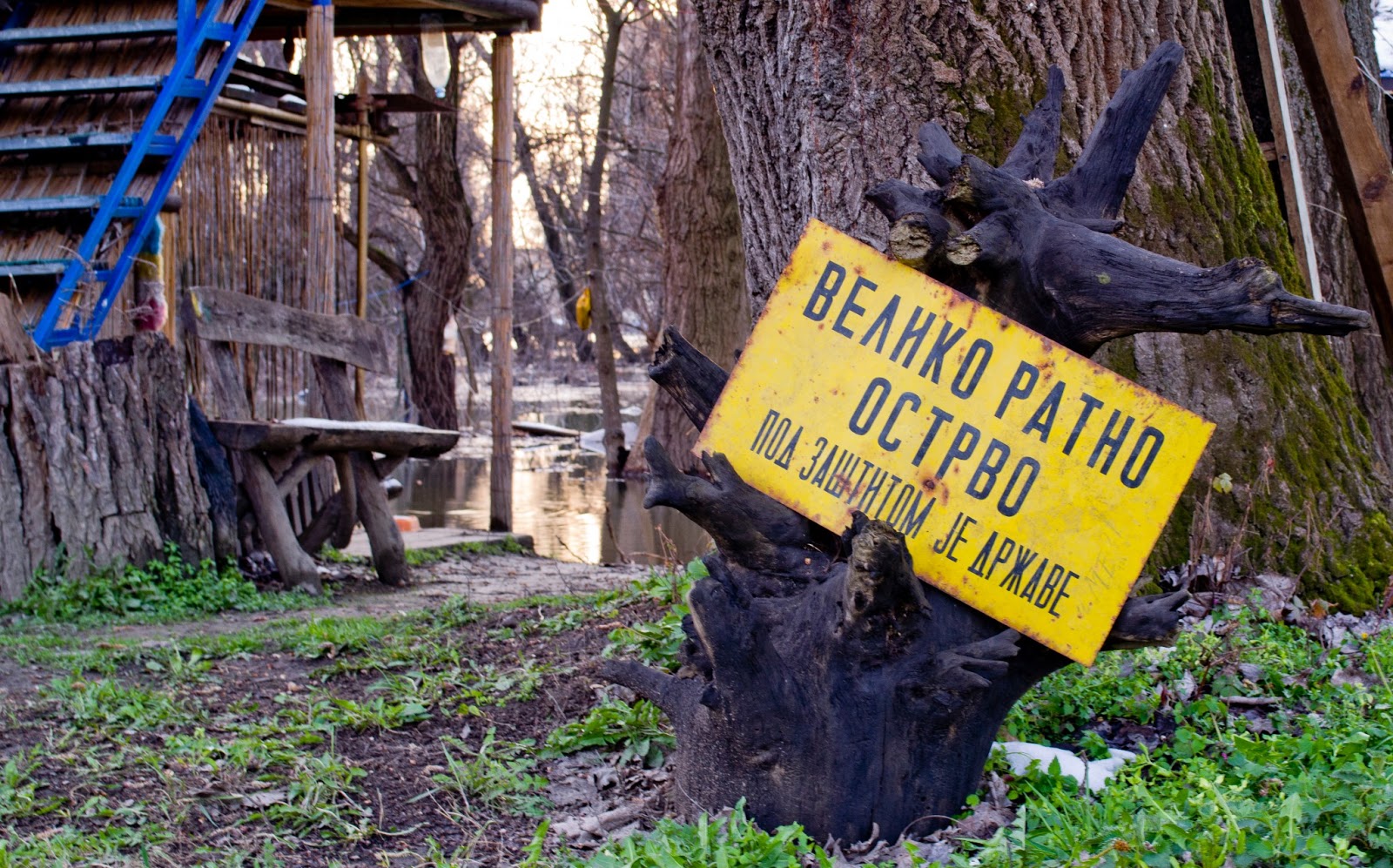
Though officially uninhabited, almost a dozen people live in small shacks in the island’s interior. They are mostly retirees who move to the island during the warm season and maintain their vegetable gardens, while in the winter they return to Belgrade.
In 2005, the island was protected by the state as a landscape of outstanding features.
There are 66 bird species which actually nest on the island, 43 non-migratory and 23 migratory birds. In winter, during the nesting period, there are some 80 species present, while in the migration season, number rises to over 100. Some of the species are pygmy cormorant, black stork, mergansers, seven species of herons, over 40 species of ducks. Altogether, 163 different bird species inhabits the island.